

The Cascadia Department of Bioregion is excited to announce that our brand new North American Watershed maps are here. These maps are beautiful, full color prints that are an educational tools to help us shift our thinking from national borders to bioregional ones. While Cascadia is fairly understood, one of the most common questions we receive is about where other watersheds and bioregions are.
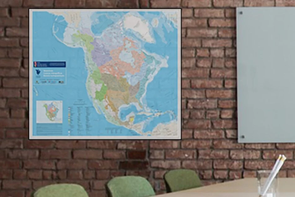
A watershed is an area that stretches from where a raindrop falls, to where it ends. Any watershed might be a part of a larger watershed, and they form the basis for larger ecoregions and bioregions. Within these large units, subsequently smaller units encompass the drainage areas of smaller rivers and streams. Water is the lifeblood of any bioregion, and every bioregion starts with it’s watersheds. This map depicts in full color and detail the different watershed basins and regions located within North America at a scale of 1:10,000,000.
This map shows the major North American drainage basins, or watersheds, which drain into the Atlantic Ocean, Hudson Bay, Arctic Ocean, Pacific Ocean, Gulf of Mexico and Caribean Sea. Each watershed is shown in it’s own color, with subdivisions shown in tonal variations. Areas of internal drainage, which lack outlets to the sea, are shown in gray.
Watersheds are classified differently in Canada, Mexico and the United States; the data set includes a continental classification (the North American Watershed, or NAW level), as well as the classification unique to each country. This data set was compiled from each country’s watershed file and adjustments were made to the data to resolve misalignments and mismatches across international borders.
This map was created as part of a joint effort by the Atlas of Canada, Instutto Nacional de Estadistica, Geografia e Informatica and the Commission for Environmental Cooperation (CEC), and is a reprint edition made with permission of the original creators and with full attribution. Contains information licensed under the Open Government Licence – Canada.
Maps are 27x34 in full color using 70lb gloss poster paper. Printed in Cascadia.
